This is a 3 days backpacking trip starting from Horseshoe Meadows in Inyo National Forest. The area is south of Lone Pine, CA and an hour drive from Mt. Whitney Portal. Mt. Langley is only about 500 feet shorter than Mt. Whitney, which offers a great view of the surrounding area, and it sees far less hikers and permit can be picked up last minute.

overview
Mileage and elevation: About 20 miles round trip and approximately 5,000 ft. of elevation gain including a side trip to Muir Lake.
Mt. Langley: 9th tallest peak in California, one of the official California fourteeners. 14,026 ft tall.
Region: Horseshoe Meadow in Inyo National Forest, Central California, near the town of Lone Pine, CA
Trailhead exact GPS: 36.453201,-118.169863
Permit: A FREE permit for you and your group must be picked up from a ranger station or a visitor center. The Eastern Sierra Interagency Visitor Center is the closest place where you do that. There is a entrance quota limited per day but they are chill here. Half of the permits are first come, first served. This place is popular on the weekends, so come early than later. Here’s the gps coordinator for the visitor center: 36.578592,-118.057465
Campground: there are two large campgrounds, first come, first served, right at the horseshoe meadow trailhead. If you come late in the day, you may choose to camp here overnight before your journey. Or camp here and do day hike to the lakes if backpacking isn’t an option. There is a one night only limitation for staying here, though.
Parking: There is a large parking lot right at the trailhead. You can leave your car here as many nights as you want.
Backpacking rules: Bear canister is a must, and it can be borrowed from the visitor center. Wilderness permit is required for all your night stays. Camp more than 100 feet from water and trail, and avoid camping on vegetation, reuse campsite if possible. You can virtually camp anywhere in the wilderness area.
Route: There are many ways to summit Mt. Langley. I started in Horseshoe Meadow and ascend via the Cottonwood Lakes and the New Army Pass and descend into Cottonwood Lake basin via Old Army Pass and exit using the same Cottonwood Lakes trail to the starting parking lot. Below is the map.
Trail condition: Trails are very easy to follow and well marked. Trails will see dozens of groups of hikers on most weekends during summer time. The topo map doesn’t show the trail that leads to the summit from the new army pass but you can easily spot and follow the hiker-made trail to the top. A map and a compass are always helpful and essential to have, but it’s not a deal breaker in this case.
Nearby attractions: Mobius Arch in Alabama Hills (filming location of many old western movies), Historic Manzanar Japanese Internment Camp, and Death Valley National Park.
map/route

the trip
It was a thursday morning when I left southern California and headed up north to Inyo National Forest. After 4 hours of driving behind slow trucks, i made it to Lone Pine, CA. I managed to pick up a permit. It was easy enough as there weren’t a lot of people. With much excited, I immediately headed up to the trailhead. This was my first solo backpacking trip as well as the first peak above 14,000 ft i’ve ever summited. You can imagine that I was very excited to do this.

I started hiking around 2:30pm and saw three groups of day hikers coming down the trail. I stopped and chat with a few of them about casual things like the weather and all that. Along the trail, there are so many meadows and shade to sit and take in the view while downing my trail mix. My pack was 27 pounds including 3 liters of water and food enough for 4 days.

I followed the New Army Pass trail from an obviously marked junction and after a couple of hours, i finally reached Cottonwood Lake 1. I immediately stopped, took a deep breath, and slowly walked toward the lake. I found a high rock to climb up to get a better view of the lake. I must say that the site was beautiful beyond believe.


I still had a few of hours of day light left, so i wanted to give myself a head start tomorrow by hiking further up to camp at High lake for the first night. High lake is really a 10-15 minutes hike from Long Lake, and it offers a much higher and more dramatic view of the area below. The sunset and sunrise are awesome from this point. I highly suggest that you camp at High Lake.

I made instant ramen for dinner. The hot soup and the spicy taste were exactly what I needed in that cold and breezing weather. I had plenty of energy left to walked around the lake and explored around the area until the sun disappears from the horizon. I headed back to my tent and finished the last 3 chapters of Desert Solitaire by Edward Abbey. The loner attitude of the book made me appreciate the lack of company even more. I started this book 4 months ago during my trip to Zion.


I rose early the next day. But i was in no hurry and took over 3 hours to get ready for the hike. A fight with my bear can took a while before i was able to open it and get my food out. I made hot tea and ate a couple of bag of oatmeals. I sat by the lake and took a mental picture of the place.
It was almost 10am when I left the camp. I caught up with a group of hikers after ascending up the New Army Pass. We stopped and chatted. I was glad to have another group of hikers nearby. It made me feel more safe.
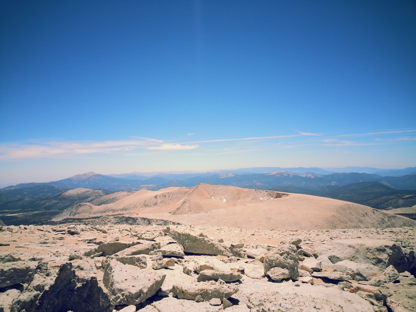
Once you make the initial climb up from High Lake, you will find yourself standing on a huge flat plateau area. You will find a post in the middle that says “New Army Pass”, this marks your entrance into Sequoia National Park (no pet and firearm allowed). Walk across the area to the other side toward Mt. Langley, which you should be able to see obviously now.

You will descend down toward Mt. Langley. After a few switchbacks, I suggest that you look across and you will see another trail that leads toward Mt. Langley. You can get off trail a little bit here and catch the other trail up toward the mountain.


The climb becomes more difficult here and it is all up to the summit. It is about 4.5 miles from High Lake to the top. I was carrying my pack with me, so it slowed me down a bit.
The trail is obvious and easy to follow. The view becomes more and more stunning with the lakes on your left and Sequoia National Park on your right.
I took a short nap before making my last push toward the top. The climb requires some class 3 scramble up as the trail disappears. The climb requires no technical skills. If you’ve spent enough time playing in the playground as a child, this climb should be okay for you.


Finally, i reached the summit! It was the first fourteener I reached. After congratulating myself and long break, I descend down the mountain with another older gentleman, Wayne. Who guided me down the Old Army Pass. The pass was still covered in snow in some sections. Wayne was nice enough to let me borrow his crampons while he used his ice axe to safely cross the snow.


After i reached the cottonwood lakes basin, I thanked Wayne for helping me out, exchanged number, and hopefully I will see him in the future. Nice people don’t come along very often in this world.
After looking around for a bit, i settle down right by Lake number 5. Tonight’s dinner was chicken cous cous. I hiked around the area, climbed some rocks, and walked on top of different hills and rock formation to get better views of the area. Marmots are everywhere here as well as the mosquitoes.


I headed to bed super early that night around 9pm. The next day I woke up early as usual and took my sweet time. I had my chai by the lake and enjoyed my own company. I hiked out as hikers started rolling in around 11am. It was Saturday and it would be crowded that night.

I easily followed the trail out and did a side trip to Muir Lake. The trail to Muir Lake is a bit less travelled and faded in some area. But there are stacked rocks that guide you along the way. In my opinion, Muir Lake is not to be missed. While other lakes get all the hikers, Muir Lake is out of the way and you will find solitude here. I hung out for almost an hour before heading out.


Nice people i meet on the trail
Right when i left the parking lot, i realized that i forgot one very essential tool, a lighter or matches. I was frustrated and thought that i had to cut my trip short. I hiked out and unsuccessfully unable to find a lighter in my car. I walked over to meet with another group of hikers who were camping at the Horseshoe Meadow for the night.
I politely asked if they had any additional lighter or matches that I could have. I didn’t have cash then so i wasn’t going to be able to pay. Luckily, they were kind enough to give me a handful of matches. I was grateful for such act of kindness. i thanked them and wished them luck. They’re on a 10 days journey to Mt. Whitney. I met with them again on my hike out and chatted for a good 10 minutes. What a nice bunch of guys.
On my ascend, I met with a group of UCSB students. I really appreciate a quick chat with them and thank you them for helping me identify the new trail up to the summit.
Wayne, the man who let me borrowed crampons, can I say thank you again? That was so kind of him to let me borrow his gear and scarifying his own safety. This is why I love travelling alone in the wild. I meet the best kinds of people out there.
That is it! that was my first backpacking trip. I didn’t get hurt and i didn’t lose anything. Feel free to ask me any questions, and i am more than happy to answer them!

How wonderful! Beautiful pictures – looks very peaceful.
Great write up! I am doing my first solo Langley attempt next weekend, July 19-21. How much snow was on the Old Army Pass and do you think there will still be snow on the pass? I plan on going through the 5 lakes, up Old Army and back the same way.
Hey Trevor, when i did it there were three patches of snow on the trail. Two could be easily avoided but one right at the top is a bit more tricky. I saw groups of people doing it without any special gears (crampon, ice axe, etc) but i think that it’s pretty unsafe. I don’t consider myself an overly cautious person but i thought that it was quite unsafe to cross without proper gear. Now, that was probably a month ago and with such hot days, i’m sure the snow is much less. I think that you should be fine. but you are unsure, maybe just bring an ice axe? it’s a short section but it’s a long drop if you fall.
Great write-up! I am planning on making this trip in September and your entry is helping a lot for my preparation. I had a couple questions and your response would be greatly appreciated:
What are the rules on campfires?
How did you heat up your noodles?
How much water did you take?
What size pack did you have (in liters)?
And any other additional tips would also help! Thanks!
Hey John, thanks for stopping by! I’m glad that you find it helpful. I’d love to answer your questions.
1. Horseshoe Meadows is in Inyo National Forest, and I believe that they just prohibit campfire everywhere in the park. You can call the ranger to confirm but I’m pretty sure that it isn’t allowed anywhere anymore this summer.
2. In terms of cooking, I brought MSR backpacking stove, so I heated up my food that way. I didn’t use fire.
3. I only brought 2 liters of water to begin with. I carried the sawyer squeeze water filter and i purify my water along the way when needed.
4. I use the osprey talon 44 so it’s 44 liters.
Other good to know is that you must carry a bear can, but you can get that from the ranger station.
Make sure you get a permit from the eastern sierras interagency station in lone pine before you start your trip.
I’m not sure which trail you’re taking but if you’re hiking over the Old Army Pass, there could still be some snow, though, it shouldn’t be significant at all.
That’s it! let me know if you have other questions!
Was altitude sickness an issue with you? We are going up this weekend for the same trip but will be going to the summit by old army pass. We leave from San Diego (Sea Level) and will be headed up to the lakes to camp the first day (11,200 ft)… Great post by the way. Love the pictures and story.
Hey Chris,
Thanks for stopping by! No, altitude was not an issue for me at all. But i rarely ever get altitude sickness. The only time it was an issue for me was when I ascended up Whitney in one day and i didn’t acclimate at all.
However, i did a teenager puking off the trail, though. But i think that it should really be okay. The hike is pretty gradual and isn’t hard so you should be okay even if you do get headache or feeling drain as a result of altitude sickness.
Thanks again and let me know if you have any questions!
met them in April. They told me they were looking for senoome upbeat and fun, and a friend from Michelle & Aaron’s wedding referred me. These two are so relaxed and fun. I just loved how natural they were in front of the