If you’re looking to challenge yourself this weekend, I suggest you ascend the summit of the tallest peak in LA county, Mt. Baldy, or Old Baldy, or officially known as Mount San Antonio.
What
The mountain is located in Angeles National Forest. It’s dominating peak can be seen from distance. It is called baldy because it’s so tall that there are no trees at the top. At 10,068 ft. tall, Mt.Baldy has no rival nearby. Only two mountains that top Baldy are San Gorgonio and Mt. Jacinto, which I’ve yet to climbed.

Mount. Baldy is a great full day hike, and it is suitable for people of all ages who are physically fit enough for the challenge. Being one of the most popular hikes in Southern California, on a nice day during summer, nearly 100 hikers try for the summit. It is also conveniently located just right outside of Claremont, which is another reason why I think that everyone in LA and OC area should definitely try out for this monster at least once. There is no doubt that this is one of the most challenging hikes out there in Southern California, but that shouldn’t stop you from trying. I believe that everyone should be able to get to the top with enough time, enough water, and delicious trail mix and food.

If you’re afraid that you may not make it, being a ski resort, you can take the baldy ski lift up half way. This way, it will take off a 6 miles off the hike, which will make it much easier. The ski lift costs $20, which I think is pretty expensive especially when I think I can just walk up the mountain.
Trail Route & Info: ascend via Devil’s Backbone and back down via Ski Hut
I have done this hike twice and I think that everyone should try to do the whole thing without taking the ski lift. There are many trails that lead you up to the summit. One starting from Baldy village which is nearly 20 miles round trip and topping 5000 ft of elevation gain. I’m not that hardcore, so I recommend that you take the Devil’s Backbone trail up to Top of the Notch restaurant and take the Ski Hut trail down.

Length: ~14 miles
Time: 6-9 hours (depending on your speed and rest stops)
Parking: street parking
Cost: Free
Permit: Adventure Pass is required to be displayed on your vehicle. It can purchase at the visitor center in Baldy village for $5 per day. Notes that Adventure Pass costs $30 for the whole year and an additional pass can be added for only $5.

Trail Description
Once you park, try to spot a single stall restroom potty. Once you find it, you will see that the paved road continue pass a close gate; that’s the beginning of your 14 miles journey. Just simply walk pass the gate on the paved road for two miles. You will then see a nice waterfall (depends on what time of year) on your left, then the trail turns into dirt road and continues on switchbacks all the way up to the Top of the Notch restaurant.

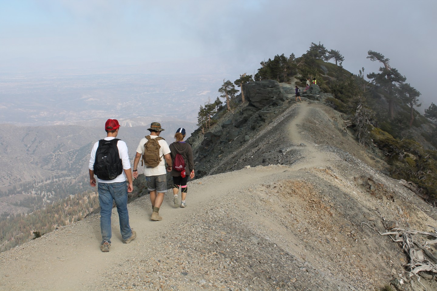
You will hike for about a couple of miles and then you will see a split with a sign that says “Mt. Baldy” next to a trail that seems to go straight up the hill on your left side; that is the Ski Hut trail. If you want to ascent via Devil’s Backbone, you will just continue on the trail that you’re already on, meaning don’t follow the sign. When you descend via Ski Hut, that is where you’ll return.

Once you see the restaurant, just make a left and hike toward the restaurant. This is the perfect place to stop, refill water, use restroom, and maybe hang out for a bit. At this point, it is half way and things about to get real!

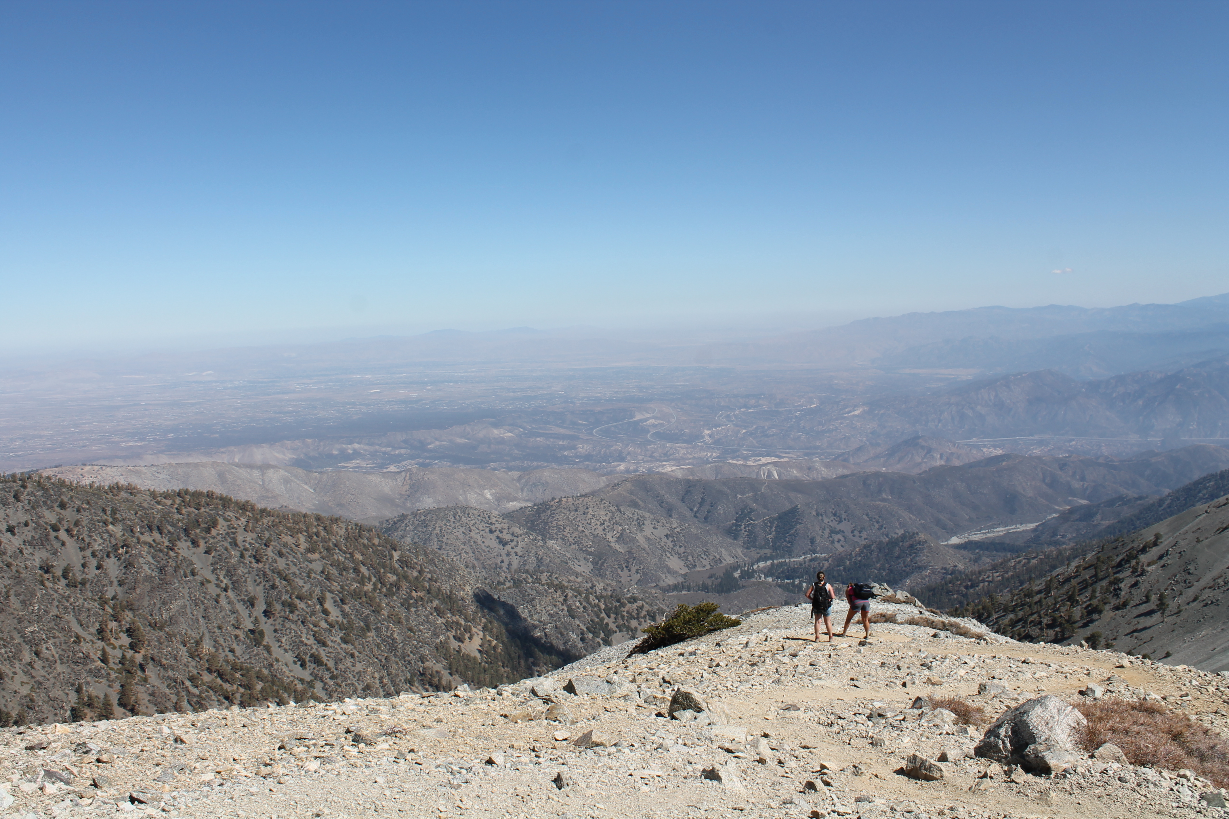
Now, the first climb after the restaurant may seem like a big shock because of how steep it is. It is not like that the entire way. There will be some flat parts but mostly pretty steep climb especially the last half a mile. Take a lot of breaks, enjoy the view, and remember that this isn’t a race. Once you read the summit, it will be all worth it. The view is amazing and it literally stole my breath. Now I spent about an hour just hanging out up there and staring into the distance. I loved the view so much!

Ski Hut trail is on the left side of Devil’s Backbone. It’s hard to explain because there’s no trail mark. If you’re not sure, I’m 100% sure that someone at the top will, so ask around. Ski Hut is steep, so take your time. I tripped and fell a few times. Now, it is all down hill and easy but hard on your knees. After the hike, I recommend you go grab some nice good dinner that is heavy on protein, carbs, and deliciousness.


Directions To Trail Head
From most parts of LA and OC, you will take 210 east toward San Bernardino. You will take the Baseline Rd exit, turn left on Base line and immediate right on Padua Ave and then right on Baldy rd. You will stay on Baldy road for about 10 miles. You can stop in Baldy village for restroom breaks, breakfasts, and many other conveniences. However, I just went straight to the trail head.
Once you drive pass the visitor center (which is obvious with a decent size sign), you will see that the road continues on a few switchbacks, there will be a sign that says Icehouse road (don’t go that way), just continue on baldy road until you drive pass a campground and then you will see a V shape split, now is the time to find parking. Most likely, there will be many other cars there already. Trail head will be on the left side; you can tell by a single restroom potty.
If you type in Mt. Baldy on Google, it should certainly take you to the right place. It is quite popular. Get more facts and info on the hike from Localhikes.com


Wow, that looks like a great challenge. Kind of similar to my very own Mt. Dana and Half Dome hikes in Yosemite. It will give you killer calves!
Thank you very much for your comment! I have never hiked either half dome or dana but I will definitely one day! this hike was quite challenging, but it was not too bad. I took my time, stop when i needed to, and drank a ton of water! do you have any other hikes you want to recommend up in norcal?
We just got back from Pt. Reyes National Seashore and Tomales Bay State Park. Both are fabulous….with dozens of different hikes. Through coastal mountains, estuaries, fern filled forests, across ridges, and to the beach. We mountain biked a couple of them, and hiked the rest.
that sounds amazing! definitely want to visit those places. thanks for your suggestions and comments!
Looks like a great hike!
It was really a great hike! I loved it so much and have done it twice already. You must do it. The view from the summit was just stunning.