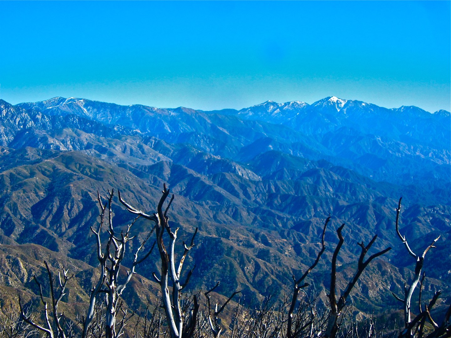
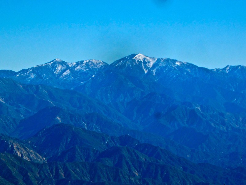
I think i’ve found a new favorite hike in Los Angeles. San Gabriel is a trail I’d like to revisit many times in the future, especially on a clearer day. After researching for trails to hike in Angeles National Forest, San Gabriel is one of the most recommended. This trail is less crowded than the nearby Mt. Wilson, which is fantastic because San Gabriel actually offers a much more spectacular view and is easier to summit. From the top, you will get a 360 view of the surrounding area because there is not another peak that blocks the view. You’ll be able to see the entire city of Los Angles from Downtown to Burbank to Santa Monica, and even Catalina Island on a clear day. If you look toward the mountains, you will be able to see Mt. Baldy, San Gorgonio, and San Jacinto. According to the Sierra Clubs, on a really clear day (really clear!), you will be able to see all the 49 peaks above 5000 ft from here.

overview
Where: Angeles National Forest near La Canada just miles pass Switzer Picnic Area
Difficulty: moderate with some steep hills
Distance: 4 miles round trip out and back
Elevation: Near 2,000 although I’m not 100% sure but it’s around there
Location GPS: 34.239342,-118.093312 (this leads to the trail head)
How to find the trail: From 210 east hwy, get off at Angeles Crest HWY and continue to the road passing Switzer Picnic Area (about 17 miles off the once you enter the park territory), then you will see Red Box picnic area on your right or a sign that ways Mt. Wilson with an American Indian Cultural Center. Turn right and continue on the Mt. Wilson road passing the picnic area (you should stop here to use the restroom though) for about 5 miles or so and you will see that a small parking space on your right and a larger one on your left, park wherever. The trail starts from the gate on your right (which should be closed off). Walk on this old road and through the tunnel for less than a mile and you will enter a large opening area with a few trails off to different directions. On your left, there’s a small sign that says Mt. Lowe. This is NOT the trail. On the opposite side to your right is the right trail. It is unmarked, but it looks like a steeper trail going up the mountain on your right, which is San Gabriel Peak.

First, I thought that i was in a completely wrong place. I got the GPS from modernhiker, which led me to this parking lot. I walked through the gate and continued on the old road. I was deciding whether to go back to the car and drive back to the Red Box picnic area or not because i wasn’t sure if I was on the right path. But i decided that to just continue walking anyways even though I had no idea where this was leading.
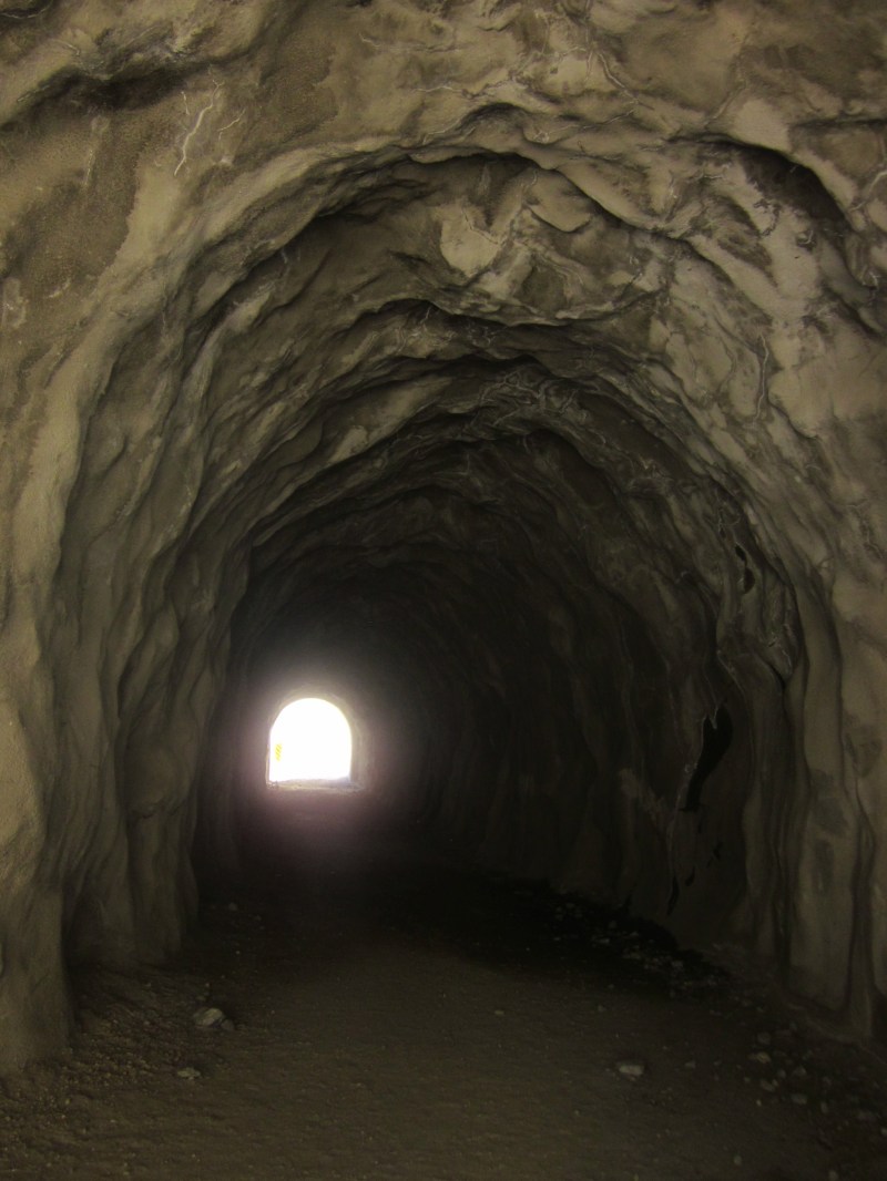
I saw a tunnel and was really excited because it just looked so cool. Not long after the tunnel, i came up this wide open area. I saw a small trail mark that says Mt. Lowe. At this point, I was sure that I was lost. I was about to just do the Mt. Lowe loop instead of San Gabriel Peak, which was the trail I originally came here for. But I looked it up on my phone (yes, I had service), and it says that Mt. Lowe is a 11 mile trail. Now, i’m not a wimp, but I didn’t prepare for such a long hike and I definitely did not have enough water or food or time really.
But then I saw a man in blue shirt on the side of the mountain walking up, so I assume that it could be San Gabriel. I then looked down to the right and saw a small trail. It is unmarked, but I thought “what the heck, I’ll just hike and see how far I go”.
Luckily, an older gentleman hiked down and told me that this was in fact San Gabriel Peak trail. I was happy and marched on the trail. This really teaches me that It’s always better to read and memorize or print out a written direction from a website. Even with GPS, i can still get confused.

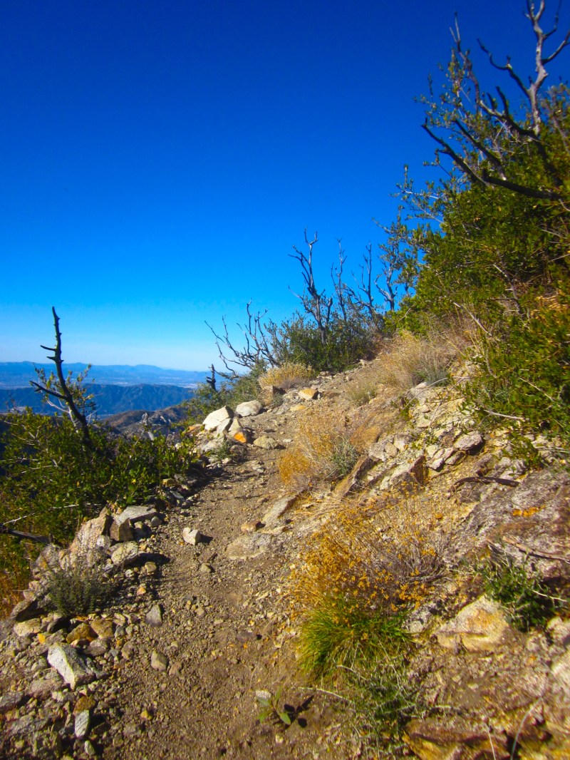
It’s a steep trail but it went by rather quickly because it was just about 2 miles up. On the way, I met this friendly and knowledgable hiker named Peter who told me a lot of the history of this trail. For example, on the way up to the peak, you will see a large opening area right because the last push to the summit. This area used to be the setting on a missile station during the Cold War.
He also pointed out a lot of things that I wouldn’t have known such as which peak is which. It was great to have him as a company at the summit. Not too long, he went back down.
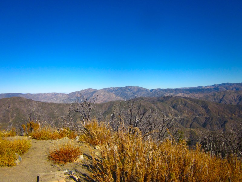
I spent more than an hour at the top just enjoying the view. I was rather surprised by the stunning view from such a short and easy hike. It probably took me 45 minutes or so to get to the summit. The view is so well worth it. I could see downtown LA, Hollywood, Santa Monica, Catalina Island, and the three monsters of Southern California; Baldy, Jacinto, and Gorgonio.

It was a clearer day than most, but yes, it was still rather foggy and smoggy. I’m planning to go back again right after rain to take avantage of this magnificent view. I highly recommend that you do this trail as a short morning or afternoon hike. It won’t take you more than two hours of hiking, but make sure to spend sometime at the top. It’s one of my favorites in the Angeles National Forest for sure.
If you’re looking for more hikes in the Angeles National Forest, I highly recommend this blog called Hiking Angles Forest. He’s a fellow wordpresser and his blog has some of the most comprehensive hikes in the park I’ve ever come across.

Beautiful hike! And very doable – not overly long. Love the hand-carved tunnel!
It was beautiful! and i didn’t know about the tunnel so i was extra excited when i saw the tunnel.
Interestingly your app gave you the wrong info on Mt. Lowe. You were just over a mile away and less gain than reaching SGP from where you were. SGP is the better peak anyway! Definitely my favorite in Front Country. Next time give the trailhead closer to Red Box a try as there is very little evidence of the fire on that route. Thanks for the shout out by the way!
I will definitely try a different route next time. The hike is rather short, though. How can i extend the trail? Is there a different starting I can do to make this a more difficult hike?
You started from Eaton Saddle. There is another starting point closer to Red Box which will add over 600′ of gain in around 0.6 extra miles–so more strenuous. Also, more beautiful as there is very little evidence of the fire along that route. Here’s a link to the trailhead: http://hikingangelesforest.com/hikes/trailheads/san-gabriel-peak-trailhead/ I’ve personally hiked a 20.6 mile, 6563′ gain hike from there. There are numerous ways to extend the hike. Let me know a range of how far you would like to hike and I’ll suggest a good extension or two.