
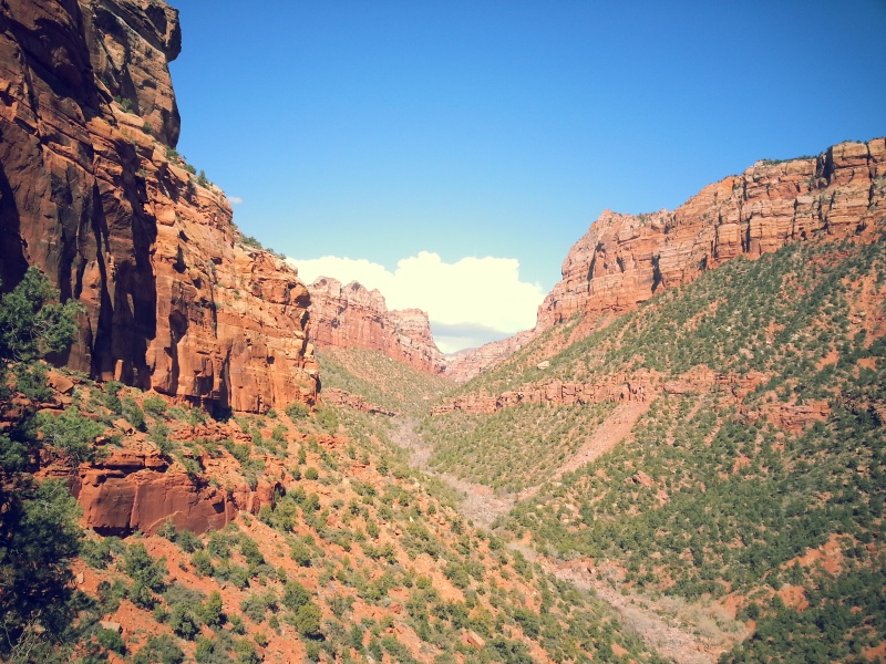
This is my favorite hike in Zion National Park. Well, from the ones that I’ve done so far. There is infinite hiking opportunity in that giant place. This awesome and fun trail will take you along the unmarked river which will eventually ends at the famous Subway. It’s a rock formation that create a subway like tunnel like the picture below.

overview
The trail starts at the Left Fork Trailhead outside of the main Zion Canyon. You will need a permit for this hike. This is a 9 miles unmarked trail that is largely flat but require many river crossing and boulder climbing and jumping. There’s also no official national park trail but there’s a social trail that has been created by all the people who’ve travelled to the Subway.
Miles: 9 miles round trip
Where: Left fork in Zion National Park (GPS: 37.284639,-113.096223)
Difficulty: moderate but could be strenuous without proper gear and preparation
Route: no official trail and require some route finding but pretty straight forward
permit
If you’re now serious about going, apply for permit here. The trail is popular and is limited to 80 people per day. I talked to a guy from Zion Outfitters and he said that hundreds of people could apply for the permit on a single day, so it’s literally like a real lottery. I was able to get my permit the day before unplanned because spring is not a popular season. Since i was doing it alone, it just cost me $10.
directions to trailhead
From Springdale, Zion visitor center, or the main canyon, you will continue out from the park on 9 toward the town Virgin. Once you get to Virgin, make sure to turn right on Kolob Terrance road. It will be one of the first right after you reach the town. It comes quick, so don’t miss it. Kolob Terrance road will lead you to the northwest part of the park which is a bit less travelled and more primitive. The road to the trail is beautiful so make sure to leave sometime for pictures.
You will continue driving on the Kolob Terrance Road for about 7-8 miles passing Right Fork trailhead and Grapevine trailhead. Once you drive pass Smith Mesa unpaved road junction, the Left Fork should come up fairly soon. Turn left and park there. Come early because it’s a big parking lot but not if all the permits are issued.
Here’s the exact GPS for you: 37.284639,-113.096223
the hike
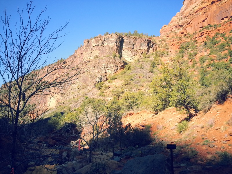
The well maintained left fork trail leaves from the parking lot next to the restroom and it will drop down into the river below in the canyon. From the restroom, you will probably see two different trails. Because it’s poorly marked, people go off in different directions. I picked to follow the larger trails. There will be many sets of footsteps so make sure to follow them. All footsteps will eventually lead you to the right trail. You may find yourself drop down on to a dry creek. Turn left and continue walking. Now you will see a small trail going off on the right, follow that and you will be hiking on the left fork trail for about 5 minutes before you will begin descending down the steep ridge into the canyon.
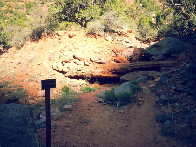
Once you reach the bottom of the trail, you will see a big creek/small river. This will be the stream that you will follow. To get to the subway, you will hike upstream, so to the left. I recommend that you turn around and take a good look right here so you don’t miss the exit. A lot of people tend to get lost on their way out because you can’t find where to exit. I use the black rock cliff formation as my guide. I also tied my bandana to a tree as a sign.
You can also see the post that says “left fork trail ->”. So make sure to take a picture of this location or remember it. You don’t want to miss this way out!
Then you will be hiking up the stream following the creek. There’s only one creek so just make sure to stick to it and you can’t get lost.
Look up from the ground often and keep yourself oriented so you won’t be confused on your way out.

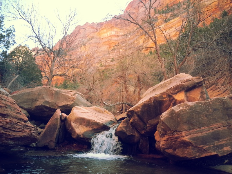
The hike is absolutely stunning with trees, amazing red cliff, and mini falls throughout the hike.
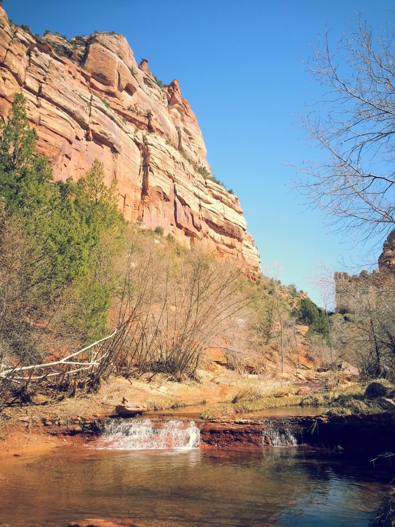
I started around 10am or 10:30am and was done around 4pm. Make sure to enjoy every moment on this trail. I stopped and have lunch at this waterfalls below. It was just so peaceful and pleasing to look at.

At some points, you may find that the creeks split off into different directions. No worries, because they will tie back together. They all are the same creek, so it doesn’t matter if you want to follow the left or right side.
Although there’s no official trail, enough people have done it to create a social trail that you can easily follow. But stay to the creek.
Make smart choices and climb over boulders that are too big. I would say that from my experiences, crossing the creek is much safer than trying to jump from one boulder to another. Yes, you will get wet but it’s also more safe. That’s a part of why I rented my water shoes. I wanted to be able to enjoy going into the water without freezing my toes off.
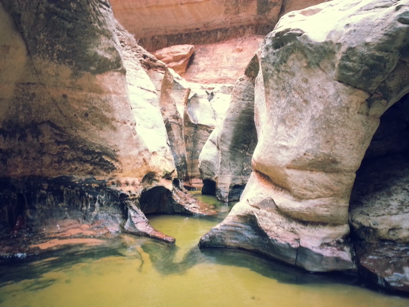
Eventually, you will start hiking up many levels of mini falls and you will find yourself looking at the entrance of the subway! It’s a stunning site.
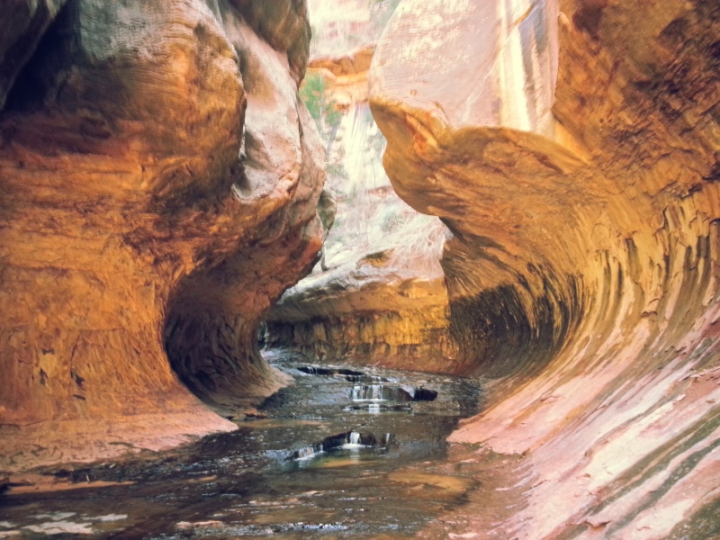
When you go inside, you will find that the subway is quite short. And below is marks the end of the canyon. If you’re into canyoneering, you can do a top down route. More info on the national park website.
personal experience
This hike was so much fun. I rented neoprene shoes and socks from Zion Outfitters which was really helpful since i was able to just walk into the creek. Other people seem to be risking their lives over trying not to get wet by jumping from one boulder to another. I thought that it was much for fun when you just hike into the creek.
However, without the appropriate footwear, hiking in the creek could be quite daunting because of the cold water temperature.
I met a nice family of five during the hike and we helped each other find the route down into the canyon. But because i wanted to be back to the main canyon by 5pm, I marched on and met up with them again on my way out.
I had a ton of fun jumping over rocks and scrambling trying to find ways to continue up the stream. Although it was a really flat trail, you will get tired from climbing over the rocks. I had a ton of fun and was not tired at all. It was a much more enjoyable hiking experience than the usual trail.
I was so glad that i decided to stay another day in zion to do this. I was a bit apprehensive at first because I did not want to get lost alone. Especially after my nerve wrecking Mt. Baldy experience.
But I thought to myself, when will be the next time that I’m back in Zion? So I decided to do it. I got my permit and my rented gear. I went out into the town the night before and tried to find descriptive trail detail from different websites. I didn’t really find anything that was really all that detail which was why I spent so much time writing this post.
This has been one of the greatest experiences. It’s an amazingly beautiful trail and is much less crowded compared to other trails in Zion Canyon. Highly highly recommend!


Super informative post! Thanks for sharing your experience and all the information that can be somewhat hard to locate about specific trails. I just got back from Utah and am so excited to look through my photos!
Thank you! It was a bit hard to find descriptive information of this trail, so I thought that I’d spent a little more time writing this one for future hikers. Still feel like I didn’t cover everything but it’s a matter of guessing for others now. hahaha please post some because i’d love to see your pictures!
Totally. I just finished going through them and I am in awe at the colors and textures. I cannot wait to visit again. Thanks again for sharing!
What a beautiful trail! We have visited Zion, but never went to this location. This part of the country is truly spectacular. Thanks so much for the detailed information!
you have to visit next time! it’s quite a place.
Amazing shots! I love the first pic..looks like a painting!
thank you! i know! it’s even more unreal when you’re there in person. incredible
Beautiful! This looks like an amazing hike. I’ve got to visit Zion soon – thanks for the info on this trail!
zion was unbelievable. it truly deserves its popularity. every person should get the privilege to witness this magnificent place at least once.
Thank you for the very informative post. Some friends and I are hiking the Subway (bottom up) in a few days. I see in one of your photos you appear to be wearing 5.10 canyoneering boots, the type Zion Outfitters rents. Did you wear these for the entire hike, or did you bring other shoes for the “dry” portion of the hike? I am considering wearing some Merrel Waterpro shoes with neoprene socks. Trying to decide if I should wear these he entire hike, or switch between these an dry shoes. Any advice would be appreciated.